1. Date and Time : April 13, 2018 11:00~17:30 (6 hours and 30 minutes including half an hour break).
2. Location : Dobongsan Mountain in Seoul.
Distance and
Course : About 12.24km. Course is to start Dobongsan Information (DI)=>Eunseogam
(Hermitage) => Darak Ridge=>Podae Ridge Observation (PRO) =>Shinseondae-726m Altitude(SSD) => Seokgulam (Hermitage)=>Dobongsan Ranger Station (DRS)=>Dobong
Shelter (DS)=>Dobongsan Information. Please refer to attached route or
course map attached. As introduced at KNPS (Korea National Park Support) linked
at below, you may shorten time and distance to 3 hours and 20 minutes and 6.4
km respectively in case you climb directly from Dobongsan Information (DI) to
SSD and back to DI through the same route. http://english.knps.or.kr/Experience/ParkContent.aspx?SEQUEN=25&ParkDiv=01&HikDiv02=01&MenuNum=1&Submenu=Npp&Third=HikingCourses&Fourth=01 ,
3. Access :
As introduced at Walking Map from Dobongsan
Station (DS) to DI at the Photo, it would take about 26 minutes from Dobongsan
Station (Gate 1) with distance 2.6km. You can turn left at Gate 1 and cross
Dobong Road and turn left at end of crossing and walk up to three-way junction
and turn right. Thereafter you can walk strait to DI as introduced at relevant
photos. You shall take the same route in reverse direction on the way back to
DS for taking subway Line No. 1.
4.
Overall Remarks.
Shinseondae Course is the most hard and
difficult route at Dobongsan mountain which you have to climb and walk steep
hill and sometimes on the rock with rope support as shown at relevant photos.
But there is a good enough compensation against this so hard effort, amazing scenery
and view of rocky peak and hill. If you choose KNPS recommended route, you
could not take an opportunity to enjoy these spectacular scenery so closely
while you climb the narrow rocky pass.
5.
Detailed
Course Information
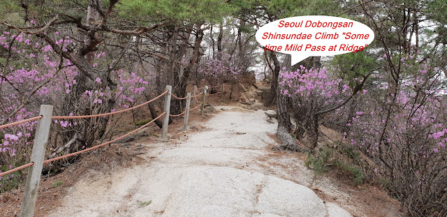
As shown at the photo of DI, I walked hill
side and found Kwangryunsa Temple at right and reached at the three way
junction where Darakwon direction at right, harder and longer distance and Jawunbong
direction at left, short cut and easy way. I took a right direction and passed
by the DRS at left and continue to walk up through stairs as you see at photo.
I met landmark saying 3.2km to JWB and continue JWB direction on Darak Ridge
with somewhat slope. I reached landmark saying 2.3km to JWB and visited
Eunseogam (Hermitage) after 5 minutes walking. It seemed they are installed
under rock or cave. Walked on Hilly pass sometimes and met wooden stairs
leading after 40 minutes walking and took a nice photo on the way up as see at
the attached. There are Mangwolsa at right on the way climb up JWB and passed narrow
and small pass under big rock as see at attached photo. I found landmark saying
1.2km to JWB after 20 minutes walking from there. It started to climb so hard
and difficult route soon after I passed by this landmark and move up rock pass
with steel rope support and reached next landmark saying 400m to JWB after 50
minutes climb. I walked on wooden stairs soon and eventually standing on the PRO
after 15 minutes climb from previous landmark and took so nice photo and movie around
Podae area. There was landmark at Podae Observation saying 300m to Jawunbong
where nearby SSD. It was the most hard and difficult highlight afterward I must
pass Y Valley, steep and narrow pass between almost vertical rock between two
side as see at the photos and finally reached SSD (726m altitude), climb to JWB
not allowed. We should enjoy SSD nearby Jawunbong alternatively. I climbed up
the SSD on top and took a so nice photo of Bukhansan Mountain far way and
indicating relevant peak as see at the photos. It was time to go down to DI and
I decided to take other short cut route as seen at DI junction Landmark when
started to climb before and downhill and turn right at junction heading to DI
direction and walked down on easy stairs road as see at the photo. I met
landmark saying 2.6km to DI and 300m to DRS and shortly visited Seokgulam
(Hermitage) on the way down and continue to walk down to reach DRS after 30
minutes. I found DS after 25 minutes from DRS and walked down with comparably easy
and good road for about 40 minutes and eventually met DI again. It was easy and
comfortable to walk down on paved road from
DI to Dobong Station through the same way as I used to come to DI this morning for
about 30 minutes walking and luckily take subway line No. 1 at 18:00 hours.


댓글 없음:
댓글 쓰기