1.
1. Date and Time : Oct 16, 2018 08:00~13:00 (5
hours including one hour break).
2.
2. Location : Choobu Myeo (Town), Geumsan-Gun
(District), Chungcheongnam-Province
3. 3. Distance and Course : About 10.11km.
Course is to start at Seodaesan Dream Resort Parking Lot => Monggol Cheon
Junction => Mineral Water Spring => Seodaesan Tangeumdae Summit (904m Altitude) => Back to
the Seodaesan Dream Resort Parking Lot through the Same Ascending Course. Please
refer to https://www.youtube.com/watch?v=7jtbmWh4Yf8

4. Access :
5.
5. Overall
Remarks.
It's the tallest mountain (904m) in Chungnam, and
made up of strange rocks and cliffs. Seodaesan (Mt.) is a rocky mountain in the shape of cone made of granite. It has thick forests and its steepness provides fun in hiking. On the top, you can see the majestic and gentle mountain range and also Daejeon afar off to the northwest. There are Wonheungsa (Temple), Gaedeoksa (Temple), and many other famous temples and Tangeumdae of Jingnyeo right before the top. And Jangmyeondae, Bukduchilseong bawi (Big Dipper Rock), Sajagul (Lion Cave), Ssalbawi (Rice Rock) can be seen around the ridge between the top and the peak no. 546 to the north. Around the 50-meter-long viaduct upon a canyon are fantastic rocks like Shinseonbawi (the immortal of Taoism Rock) and Byeoseulbawi (Government Official Rock), giving a grand view.
To get to Seodaesan (Mt.), there are two ways. One is going from Majeon on the south of Daejeon to the entrance of Seodaesan (Mt.,) Seongdang-ri, toward Okcheon. The other is going to the 3-corner crossing at the entrance of Seodaesan, along national road no. 37 from Okcheon to Daejeon. Most of the visitors use Daejeon as a starting point of hiking.
6.
6. Detailed
Course Information
I came
over to Seodaesan Dream Resort quite at 08:00 hours in the morning, less than
an hour from Gongju Forest Town, lodging where I could start to ascend over the
Seodaesan Mountain this morning. As I
parked the car at the Seodaesan Dream Resort Parking Lot, there was nobody
requesting me to pay the parking fee because I was there so early in the
morning. As soon as Parked the car, I checked hiking course map first and found
just left at the climbing stone stair road and learned there were four possible
hike course, No 1 through 4. Each Course has each merit and dis-merit like
longer or harder or tired and so on. Therefore I finally choose Corse No. 4
tasking into account applicable factors. It was so dense foggy visibility was
so poor and nearer that I could see 10m distance clearly. I personally forecasted
it would last almost full day. I walked on cornet paved road for about 20
minutes and found Monggolcheon Junction as stated at the course map. I saw Seodaesan
Dream Resort Monggolcheon which looks Mongolia Ger in general shape. But I
could not see inside arrangement how they arranged inside. It might draw people
inrest if they arranged inside conveniently and comfortably with reasonable lodging
price. Anyway I turned left at the
junction and continuously working on the same road for 2 to 3 minutes and
reached next junction which I could take either Course 1 or 2 at left and 3 or
4 at right and took a right direction road and kept walking on the same
concrete paved road and off road for about 10 minutes and reached next junction
which I could take either course 3 at left or 4 at right. I took course 4 at
right and walked down for a minute or two and found junction guiding to enter
into forest road at left and started to walk through forest hike road. I walked
on somewhat highly slopped road for about 45 minutes and reached Mineral Water
Spring and took a short break, drinking water. I tried to see around view and
found I could not see around peaks which were becoming colorful change. But I tried
to pick up nearer peaks and took it to picture. As I walked on the similar
slopped gravel soil road for about three quarter minutes and found rescue post
No 4-7 which we could use in case emergency help. I just kept walking up on a
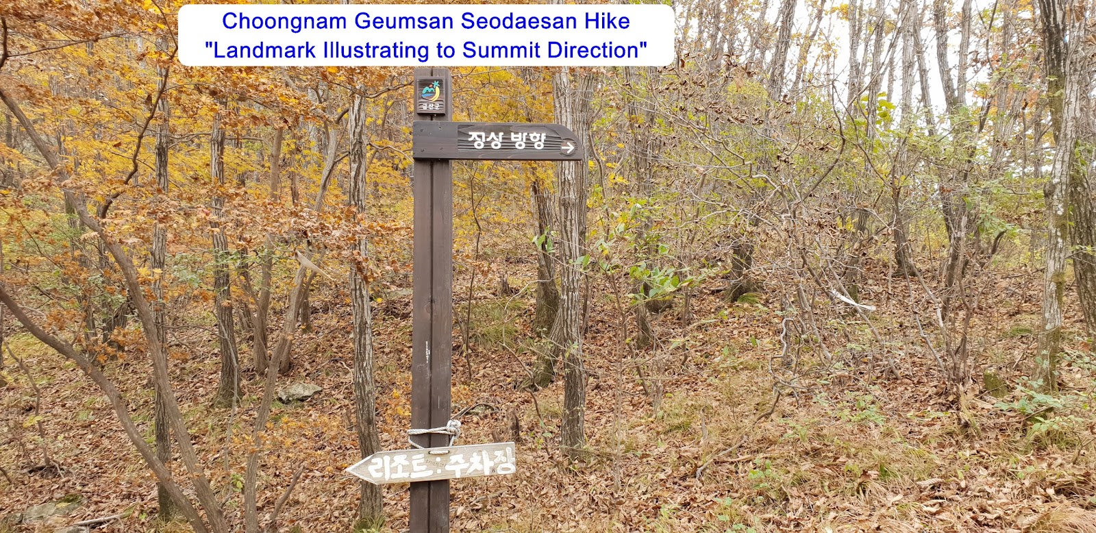
bit steeper road for a quarter minutes and met landmark indicating arrow to
Summit Direction. I continuously followed arrow direction for about 10 minutes
and reached rescue post No. 4-10 standing at steeper rocky gorge area. I turned
right at the post and continued to walk on the highly steep rocky road for
about 10 minutes and finally touched down 904m altitude Seodaesan Tangeumdae
Summit and looked around view. But I could not see almost anything due to so
dense high dust level. So I was just quickly gone through the Summit and found
proper place for lunch break and started to descend as soon as finished lunch
break and back to the Parking lot after 2 hours descending walk from the
Summit. It is my personal conclusion I could hardly understand the reason why
NPS (Nation Park Service) include this Seodaesan Mountain in the Korea 100 Mountain.
There is neither particular land scape nor
historical background, provably higher elevation. But there are many other higher
mountains than this Seodaesan which was not registered at the list.


댓글 없음:
댓글 쓰기