1.
1. Date and Time : Oct 10, 2018 10:00~16:00 (6
hours including one hour break).
2.
2. Location :. Daegang-myeon
and Dangseong-myeon, Dangyang-District, Chungcheongbuk-do Province.
3. 3. Distance and Course : About 16.15km.
Course is to start at NPS Sangseonam Parking Lot => Sangseonam Village =>
Jebong Peak => Doraksan Three Way Junction => Naegunggi Three Way
Junction => Doraksan Summit (964m Altitude) => Back to the NPS Sangseonam
Parking Lot through the Same Ascending Course. Please refer to https://www.youtube.com/watch?v=6SJ0UNhCaWo&t=2s.
4. 4. Access :
There
is a ways to connect “Seoul Cheongryangri Train Station with subway lines No. 1
where you could take ITX train bound for Danyang taking two hours and two
minutes. Please walk to Danyang Station Bus Stop taking 3 minutes for 173m as
soon as you arrive at the Danyang Station. You should take local bound for
Gosudaegyeo and Moyeoti and get off at Gasan 2ri Bus Stop taking 45 minutes for
8th Bus Stop. Please walk to NPS Wolaksan Sangseon Office taking 1
minute for 72m. Please refer more details to the “Transportation from Seoul Cheongryangri
Train Station to NPS Wolaksan Sangseon Office”. You could simply take reverse
course on your way back home. I could estimate total transportation is about 3
hour plus 30 minutes (waiting interval time) for one way which comes total 7
hours for round trip. But you would reduce this transportation time
to 5 hours for round trip in case you use private car or rent car which you
could save two hours for the transportation.
5.
5. Overall
Remarks.
Doraksan (Mt.) is
located on the border between Daegang-myeon and Danseong-myeon in Danyang-District,
Chungcheongbuk- Provice. Doraksan is at the foot of Wolaksan national park and embraces 3 out of the 8 views of Danyang. The wonderful views are outstanding. Danyang is a rugged mountainous region located in Taebaek and Sobaek mountain ranges on the east.
6.
6. Detailed
Course Information
It was a bit chilly day becoming temperature suddenly dropping down in
the morning. I was checking Doraksan Course map after parking the car at NPS
Wolaksan Sangseon Parking Lot which is arranged near to the entrance gate of NPS
Wolaksan Sangseon Office and selected the best way for me taking into account
hardness, distance and something possible view. When I walked paved road for about
15 minutes, I met three way junction at Sangseonam Village, the one through Jebong
Peak and the other through Cheunbong Peak. I picked up the former course and
moved straight at the junction and found small Sangseonam Hermitage looks cute
and calm at the foot of Doraksan Mountain as see at the photo. I passed the
Sangseonam and met landmark stating as 3km to Doraksan Summit which I could
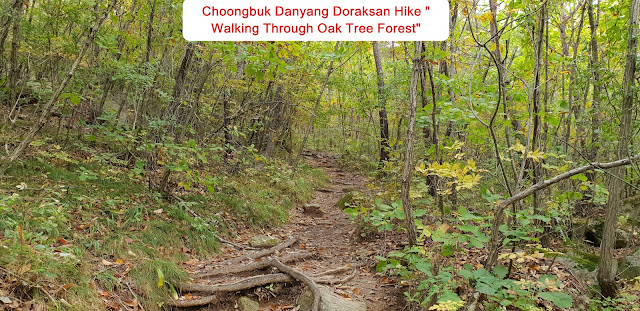
start to ascend hiking course that morning. As I walked wood log stairs, I
found smaller and deep oak tree forest which was becoming steeper sloped time
by time. I walked up this road for about half an hour and reached landmark saying
as 2.5km to the Summit via slopped big rock road connecting to highly steep wood
blog stairs. I struggled to ascend the steeper zigzag wood blog stairs and
tougher rocky road for one more half an hour and reached 2.2km to the Summit
landmark where I could remotely see Jebong Peak behind the landmark which looks
closer. I walked on the colorful ridge road for about more half an hour and found
next landmark stating as 2 km to the Summit. I kept walking deeply sloped
colorful ridge road for about 40 minutes and reached Jebong Peak where I could
see the Three Way Junction stating as 1.4km to the Summit and 1 km to Shinseondae.
As Walked on the steep rocky road and sometime mild ridge road for about one
hour, I met 1km to the Summit landmark where I could see Doraksan Summit view
which was soaring at colorful peak valley around as see at the photo. I should
still ascend steep zigzag stair road and uphill for quarter minutes and reached
three way junction, the one to 600m to the Summit and the other 300m to
Cheunbong Peak. I just followed Summit direction for a quarter minutes and reached
three way junction, the one 300m to the Summit and the other 1.4km to Naegunggi
Village. I kept going up on the steeper uphill road for a quarter minutes more
and finally touched down the Doraksan Summit elevating as 964m altitude. I tried
to look around neighboring mountains but could not see openly around due to surrounding
trees on top of the summit and started to descend the Summit and reached Shinseondae
Observation about 20 minutes from the Summit where I could see elegant and mysterious
rocks and beautiful maple trees near to gorge ridge and recorded to camera as
see at the photo. I saw one more beautiful Cheunbong Peak on the way down from the
Shinseondae and took it to the photo as see. I could now see surrounding
mountains and recorded it to the photo. I hardly came down back to NPS
Sangseonam Parking Lot via the landmark junction at
Sangseonam Hermitage after about 2 hours effort for descending from the Summit.


댓글 없음:
댓글 쓰기