1.
Date and Time : June 1, 2018 11:0~15:00 (4 hours
including break one hours).
2.
Location : Kimpo at Gyeonggi Province in Korea.
3. Distance and Course : About 6.91km.
Course is to start Munsusan Parking Lot =>Octagon Pavilion=> Munsusan Summit
(376m Altitude) => back to Munsusan Parking Lot.
4. Access :
There is various ways to connect Subway Line No.2 which you are supposed to change to Express Bus No. 3000 at Shincheon Station Bus Stop ID:13-022 referring to map of “Change Subway Line 2 at Shincheon Station to Bus Stop 13-022 Shincheon Ogueri”. Please stay with the Bus for passing 33 times bus stops with 49.6km and get off at Seongdong Geommunso Bus Stop after about 2 hours. As soon as arrived at the Bus Stop, you should take a walk for 21 minutes with 1.39km distance referring to the map of “Walking from Seongdong Geommunso to Munsusan Salimyeokjang Parking Lot”. I could estimate total transportation is about 2.5 hours for one way which comes total 5 hours for round trip. Please take reverse course on your way back home. But take Bus No. 3000 at other side of the Gangwha Road”. But you would reduce this transportation time to 3 hours for round trip in case you use private car or rent car which you could save two hours for the transportation.
4.
Overall
Remarks.
Munsusanseong has been started to erect for
the protection of Gangwha Island by Gangwha Governor as per instruction by the King
of Sookjong in 1682 and finished in 1694, 12 years construction period. There was
a severe and bloody war at this Munsusanseong against French attach from Oct 26
to Dec 17, 1866. French Army was completely withdrawn due to disastrous defeat
in the battle. But they stole Kyujanggak on the way back home which is recorded
for Korea King’s Writing like instruction or judge or notice or poet or any
others.
Munsusan
Mountain is situated at near boarder to North Korea which is less than 70km. As
you climb up the Munsusan Summit, you could see North Korea territory very
closely under normal or good visibility. I was lucky to ascend the Summit under
good visibility which I could clearly see North Korea today. You would see
color difference between South Korea and North Korea, the one green and the
other brown which is mainly due to fuel problem in North Korea. North Korea is
mainly using wood as fuel but South as gas or clean diesel.
As
introduced at the Photo of Gyeonggi Kimpo Munsusan Climb Course, There are several
climb courses to ascend the summit. I picked typical course which people mostly
take for climb, going up the ridge at right and reaching the summit through comparably
mild slope ridge and downhill through valley road on the way back after touchdown
the summit. Please see more details at the Course map attached.
5.
Detailed
Course Information
As
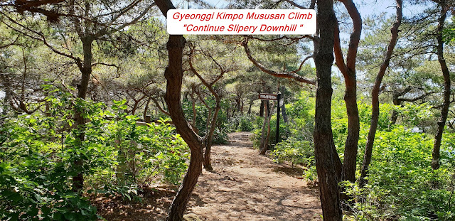
soon as parked at the Munsusan Parking lot, I moved to four Way Junction where I
could select the Climb Course, either through Ridge at Right or through valley
at middle. I turned right at the junction and started to climb the hill at
right where I could see so beautiful scenery of Gangwha Island. I reached
junction at ridge after about 5 minutes walking and took so nice picture for
the Gangwha Island and several fishing boat at the middle of Han River. When I
kept walking up the hill through oak tree forest for about 40 minutes, I found
landmark saying 1.7km to the Summit. I saw better view of Gangwha Island and fishing
bouts at the Han River and took a one more shot under pulling close picture. It
seems this picture would be more clear and obvious than before. I continued to
move up for about 20 minutes alongside Munsusan Seong and met next landmark
saying as 1.2km to the summit. There was an observation Point at the middle of
climbing road which I could see clear view of road along with the Castle. I
found Explanation of Munsusan Seong Story somewhere at middle of course road which
they explained as all most all stone is made with rectangular and different
shape and principally 13 layers at the wall. They were maintained and repaired depend
on situation and times.
Please
see more details at the Explanation Photo. I passed 1.2km Landmark after 15
minutes walking form previous landmark and kept on ascending for 10 minutes
more walking and reached the Landmark-400m to the summit. I walked through oak
tree forest for about 10 minutes and saw so beautiful Summer House on top of
the summit and took it to photo on the way up. As I move up for 3 minutes more,
I found next landmark saying as 100m to the summit and continued to walk up the
hill for about 10 minutes more, I finally touched down the Munsusan Summit
-378m altitude after passing forest hill and last stairs to mountain top. I was
fortunately getting chance to take so clear picture for North Korea Territory
which would be less than 70 km, just crossing Han River or Imjin River. Please see
North Korea is located at the other side of these rivers as you see at the
photo. I tried to return Munsusan Parking Lot as soon as I finished reviewing
North Korea Territory and moving down to Munsusan Parking Lot via Octagon
Summer house on the hill about 1 and half an hour walking from the summit


댓글 없음:
댓글 쓰기