2022년 4월 26일 화요일

Hangang River Walking Trek Course 6, South From the Missa Station to the Hanam Geomdansan Station In Seoul Metro

 1.   Preface

Hangang River is one of Major River in Korea which is starting flowing down from the Taebeak City in Gangwon Province, North East to the Ganghwa Island in West Sea and which is almost dividing half of country from North to South. Total flowing distance is estimating as 494km. There are total numbers of bridges built around Seoul and it’s metropolitan in the Hangang River as 32 pieces. But I will arrange to walk Hangang River from Gangseogu district to Hanam City in Kyeonggi Province which is estimated as total distance, 86 km and 26 walking hours and passing 22 bridges out of these total 32 bridges. Each course is principally arranging based on about 13 km distance and 4 hours walking time and starting from near subway station and finishing at designated subway station. Please see more to Attached Walking Course Summary Table and map below for bridges on the Hangang River.

Cormorant at Tiny Island on the Hangang River


Hangang Bridges


2.   Course Guide Information

Hangang River Walking Trek (HRWT) Course 6 is arranged from the Misa Station to the Hanam Geomdansan Station in the Seoul Metro Line 5 as about 13 km walking distance for about 4 hours including one hour break. We will pass Misa Daegyeo Bridge at the Hangang River and five Seongnaecheon Bridges at the Seongnaecheon Brook during the course as shown at the summary map of the Course 6 as attached below. Please refer overall Video summary linked to https://www.youtube.com/watch?v=1Wzddj6AFDo  

Hangang River Walking Trek Course 6 Map


2-1) Start the Gate 4 at the Misa Station in Seoul Metro Line 5 and move toward the Misa Sagueri Junction via Arisuro Junction as see at the Photo 1~ 6.

2-2) Move Forward the Hanam Tree Orphanage through Misa Daero (Main Street) as see at Photo 7 ~10.

2-3) Walk toward the Junction with the HRWT Course 6 via Hanam Orphanage Entrance and Gangil Over-Bridge Junction as see at Photo 11~14.

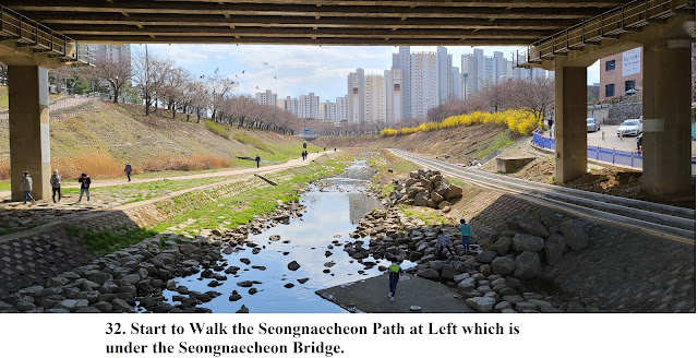
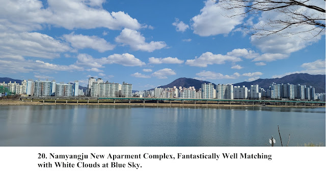
2-4) Keep walk toward the Seongnae Bridges alongside the Hangang River and enjoying so sweet nature view alongside Hangang River as see at Photo 15~38.  

3.   Historic and Background Information

There are several places or spot where some cultural and historic background which you may feel interest in or useful for your better understanding. Please refer followings for brief explanation.

3-1) Hanam City

The King Onjeo at Baekje Period was establishing his capital at this place as calling as a Wuiraeseong city and his subsequent kings and King Gaero, 21th King in Baekje Period were continuously controlling this capital for 494 years until the King Jangsu in the Goguryeo Period took over. Therefore King Gaero moved his capital to Woongjin area, presently calling as Gongju City. The Goguryeo was naturally changing the Wuiraeseong City to Hanju City which was changed again by the King Taejo, founder of Goryeo Empire to the Gwanju as the same name as present name. This area was upgrading calling as Dongbu Myeon Town at the King Seonjo controlling period 10 years in Joseon Dynasty (Village to Town Upgrading). This area was reorganized as Gwangju City in 1989 under merging three Gwangjugun District, Dongbu Eup Town and Jungbu Eup Twon and Seobu Myeon Town.

3-2) Deokpoong Cheon Brook

.The Deokpooncheon Brook was originated somewhere in the Namhansanseong Castle area and flowing down to the Hangang River via middle  of Hanam City which is ultimately reaching to the West Sea. There were upper Warehouse and lower Warehouse in Joseon Dynasty which were storing grains and others for collecting from the people as a relevant tax since convenient transportation through at this area through the Hangang River by the yellow brown mast vessel. This Deokpoongcheon was becoming swallowing time by time and naturally changed to woman’s laundry places or children’s playing area or man’s fishing area which is no more nowadays. There were many marsh snails which was a good diet to firefly and water parsley paddy one time before which is no more this scenery. Local Government made a effort to recover nature scenery and made proper living or mating area at the brook where carp are easily and comfortably living and mating since people used to see carp’s mating scene at the brook.         .      

3-3) Geomdansan Mountain   

            Geomdansan Mountain, 657m above sea level is elegantly soaring at the Hangang                 River at the East of Hanam City which is facing Yebongsan Mountain, 679m above                 sea level across the Hangang River. It is legend that the Geomdan Buddhist Monk                 was living at this Geomdansan Mountain one time who was putting mountain name as              his name as Geomdan or many goods arrived at this area from various places which             were waiting for inspection by authority because Geom alternatively means                             inspection. 


Gate 4 at Hanam Geomdansan Station

Cross the Hanam Firehouse Junction

Arisuro Junction

Deokpoonggyeo 3rd Bridge Junction


Deokpoonggyeo Bridge

Deokpoongcheon Brook


Hangang River Lower Walking Path


bird's Tiny Isalnd


Missa Daegyeo Bridge


Hanam Tree Orphanage


Missa Main Street

Missa Sagueri Junction


Arisuro Junction


Gate 4 at the Missa Station


2022년 4월 22일 금요일

Anyangcheon Creek Walking Trek Course 3, Branch of Hangang River in Seoul from the Anyang Station to Geunpo Station in Seoul Metro Line 1

 1.     Preface

Anyangcheon Creek is one major branch of Hangang River in Seoul which is starting flowing down from Kwangkyosan Mountain in Uiwang City in Kyeonggi Province and passing 7 cities in Kyeonggi Province and 7 districts in Seoul and eventually joining at Mokdong River Junction. Total flowing distance is estimating as 32.5 km which is comparably longer among other creeks in Korea. Anyhow I will arrange to trek Anyangcheon Creek Walking Trek (ACWT) from Sinmokdong Station in Seoul Metro Line 9 and Dangjeong Station in Seoul Metro Line 1 which is divided into 4 different Courses, total distance as 50 km and total walking hours as 15 hours as see at the ACWT Course Table attached. Each course is arranging with about 12 ~13 km distance and 4 hours walking including one hour break and starting from near subway station and finishing at designated subway station. Please see more details to Attached Table.


Anyangcheon Creek Walking Trek Course


2.     Course Guide Information

Anyangcheon Creek Walking Trek Course 3 is starting from the Gate 3 at the Anyang Station and end at the Gate 2 at the Geunpo Station in Seoul Metro Line 1 as about 12 km walking alongside Anyangcheon Creek for about 4 hours including 1 hour break during the Course. This Course is starting at the Gate 3 at the Anyang Station and continuously to walk behand Anil Elementary School and join the ACWT Course 3 after crossing the Anil Walking Bridge as see at the Photo 1, 2, 3, 4 and 6. Thereafter keep walking along with the Anyangcheon Creek until Aejagyeo Bridge which is 13th and last bridge during the ACWT Course 3. Please note I do not count number of bridges as the stone stepping bridges and only walking bridges but driving bridges. Please refer to Photo 8, 10, 12, 14, 19, 20, 22, 24, 26, 28, 30, 31, 32 and 34. We walk forward and toward Geunpo City Hall direction and eventually end at Gate 2 at Geunpo Station for about 20 minutes walking as soon as crossing the Aejagyeo Bridge. Please see the Photo 35, 36, 37, 39, 40, 41, 42, 43, and 44. You could refer to Anyangcheon Creek Summary Map attached and linked site to   https://www.youtube.com/watch?v=3YRPPm-XXgU&t=42s

 
Anyangcheon Creek Walking Trek Course 3

3.     Historic and Background Information

There are several places or spot where some cultural and historic background and which you may feel interest or useful for your better understanding. Please refer followings to brief explanation.

3-1) Bisan Daegyeo Bridge

The name of Bisan Daegyeo Bridge was coming from the Bisan Dong Village. The Bisan word was originated from pure Korean word as “ Nalmi” or “Nalmeo” which could be translated to Chinese Character as “ Bisan”. As we look down Bibongsan Mountain (295m Above Sea Level) and Bisan area at the Kwanaksan Mountain (632m above sea level), the Bisan Area looks like bird flying, Bisan meaning. Bisan Daegyeo Bridge was built in 1975 with 96m lng with four lane road.     

.3-2) Hogyegyeo Bridge

The Hogyedong Village was consisting with three villages as the Bangjukmal, the Saettoemal and the Anmal where the tigers used to appear at the Hogye Valley long time ago. People have called till now as I is. But some people alternatively called as the “ Beomgye Dong” Village which was translated to Chinese character meaning. Anyhow local government has later called its area name as “Hogyedong Village” under Adminostration reorganization in 1973. But its area name has again changed to Beomgyedong Village in 1992.

The Hogyegyeo Bridge was coming from the area name as Hogyedong village which was built and opened in 1996 with 62m long and 4 lane wide.   

3-3) Geunpo and Its Station

            Korea Government Army was defeated by Japanese troop while Japanese Invasion in 1592 and             inevitably withdrew to Geunpo Area. They encountered Monk’s Local Army and reorganized                with enough recovery and combated again against Japanese army and greatly gain the victory.                 The people thereafter called this area as “Geunpo” which means as military base. Geunpo                     Station was orinated from its location or area name.    

Anyang Station Gate 3


Anil Elementary School


Anil Walking Bridge

Fantastic Scenery of Anyangcheon Creek

Start to Move Anyangcheon Creek Upstream

Stone Stepping Bridge at the Anyangcheon Creek

Anilgyeo Bridge


Ipgokgyeo Bridge at Anyangcheon Creek

Remarkable Scenery of Walking Bridge

Bisan Daegyeo Bridge

Hogye Swamp Park

Another Wonderful Scenery of Anyangcheon Creek


Deokcheongyeo Bridge

Seorogyeo Bridge

Wild Flowers Blossom

Jeonpagyeo Bridge


Hoangyeo Bridge


Myeonghak Daegyeo Bridge


Geumhogyeo Bridge


Hogeumgyeo Bridge

Geunpogyeo Bridge

Mabelgyeo Bridge


Aejagyeo Bridge


Geunpo Overpass Junction


Gate 2 at Geunpo Station