2018년 11월 6일 화요일

Jeonbuk Wanju Daedunsan Mountain Hike in Korea- Course 1 and 2 via Cable Car Station Course


1.     Date and Time : Oct 31, 2018 09:00~12:00 (3 hours with including round trip cable car transportation).
2.     Location: . . Wanju-District, Jeollabuk-Province and Geumsan-District, Nonsan-City, Chungcheongnam-Province.  
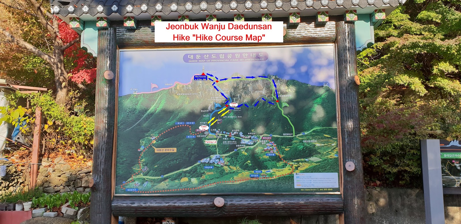
3. Distance and Course : About 5.0km. Course is to start at Cable Car High Station => Samseon Stairs => Heypgok Samgueri-Gorge Junction => Daedunsan Summit (878m Altitude) => Yongmungol => Back to the Cable Car High Station. Please see Hike Corse Map and https://www.youtube.com/watch?v=h97GZqi-4s4 
4.     Access :
There is several ways to connect “KTX Seoul Station” connecting by subway lines No. 1, 4 and AREX). Please walk to the KTX Seoul Station from the Subway Station taking 2 minutes for 240m and check boarding gate number at the information sign board and follows the information and get on KTX bound for Daejeon taking 50 minutes. When you get off at the Daejeon KTX Station, please walk to Daejeon Station Bus Stop taking 4 minute for 242m. You could get on local bus No. 413 and get off at Mueti Sagueri Bus Stop taking 18 minutes for 12 bus stop passing. Please change to local bus 34 there and get off at the Daedunsan Hyeugueso taking 50 minutes for 42 bus and walk to Daedunsan Cable Car Station taking 16 minutes for 1.1km. Please refer more details to the “Transportation from KTX Seoul Station to Daedunsan Cable Car Station”. You could simply take reverse course on your way back home. I could estimate total transportation is about 3 hours and half an hour including waiting times for one way which comes total 7 hours for round trip. But you would reduce this transportation time to 5 hours for round trip in case you use private car or rent car which you could save two hours for the transportation. 
5.     Overall Remarks.
A range of Noryeong mountain goes towards the Mangyeong plain in Gimje and forms an independent group of mountains, creating a scenic masterpiece. It is Daedunsan (Mt.). This mountain is also called Sogeumgang (Little Geumgang) in Honam. It forms wonderful rock peaks such as Chilseongbong (Peak) and Janggunbong (Peak) mixed with several mountain ranges that stretch out all around including Macheondae (878m), the summit of this mountain. The physical aspect is beautiful and graceful, harmonized with rocks like Samseonbawi (Rock), Yongmungul (Cave), Geumgangmun (Gate) and trees all around.
Especially the section between Macheondae and Nakjodae along with north ridge is a magnificent spectacle and the view of sunrise and sunset from Nakjodae is a masterpiece. It was designated as a provincial park and has become a new attraction with newly installed cable cars and Geumgang-gureumdari (Viaduct). Landing down from 5 minutes' ride in a cable car and going up steep steps, you'll see Geumgang-gureumdari which is 81m high and 50m long across Imgeumbawi (Rock) and Ipseokdae (Pedestal). There are also historic temples such as Taegosa (Temple) in Jinsan, Ansimsa (Temple) in Unju, Sinsounsa (Temple) in Byeolgok etc.
6.     Detailed Course Information
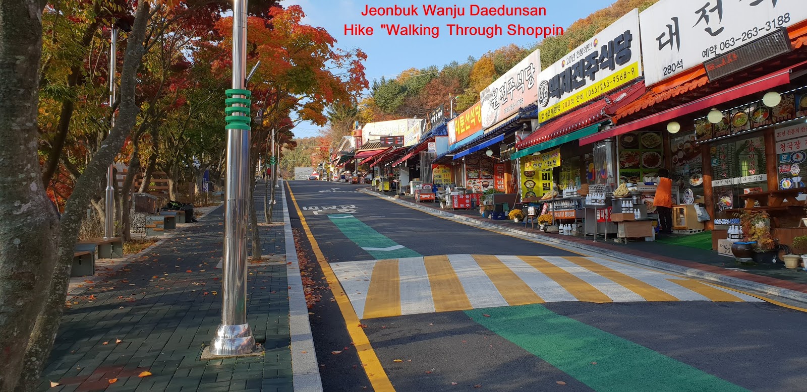
     I could come over to the Daedunsan Parking Lot somewhat before 9 o’clock and paid KRW 2,000- for parking fee and found only few cars were parked at the Parking Lot because of early in the morning. I found there were so elegant and spectacular mountains which look so beautiful landscape and picture along with colorful trees and mysterious rocks. When I came here from hotel this morning, I could easily recognize Daedunsan Mountain is there at far away since its landscape was not normal and mysterious. Anyhow I looked around and first of all checked the Hike Course Map at the Parking Lot and found there are two possible hike courses, the one Curse 1 starting from the Parking Lot area up to Macheondae Summit via Cable Car High Station and the other starting from Yongmungol Entrance to the Macheondae Summit via Yongmungol Samgeori. But I decided to combine Course 1 and 2 which means I will go up to Cable Car High Station by Cable Car and start to hike there and ascend the Course 1 up to Macheondae Summit and take Course 2 on the way down up to Yongmungol Samgeori (Junction) where I will turn right to head Cable Car High Station. When I got off the Cable Car, I recognized Daedunsan Course should be one of toughest hike course since steepness is not a normal level but extraordinary sloped course. I looked around at the Cable Car High Station and found there were many mysterious and wonderful Rocks here and there. I took such a nice and an excellent scene at the camera. I started to ascend the so steep steel stairs just out of the Cable car Station and struggled to walk up the stairs for about 5 minutes and reached junction where I could take either way 50m to the suspension bridge at left or 250m to Samseon Stairs. I made a choice to take right direction considering I could walk the suspension bridge on the way down from the Summit. But I could soon recognize I could go there to suspension bridge because I shall not return the Cable Car High Station through Course 1 after the Summit. I climbed to the Samseon Stair       from the junction for about 15 minutes walking through so steep wood stairs and rough rocky road and saw junction; either through narrow and deeply sloped steel stairs at left or through ordinary steel stairs at right. I took Samseon Steel Stairs at left and m oved a few steps and found this steel stairs were really and highly steeped steel stair road as see at the photo. I just moved up through so narrow and heavily inclined steel stairs step by step for two to three minutes and reached Samseon Rock Peak where I could see so great scenery of around rocks as see at the photo herein. I saw Macheondae Summit (878m altitude) at left and other splendid rocks at the observation on top of the Samseon Rock. Please see attached photo. I stated to climb again highly steeped rocky road and struggled to move these road for 15 minutes and reached junction at gorge where I could take a choice either going up 150m to the Macheondae Summit at left or going down 450m to the Yongmungol Samgeori at right. I took left direction road and walking up the Summit for about 10 minutes and finally touched down the 878m altitude Macheondae Summit and looked around the surrounding mountains. But I could not see the surrounding mountains around and instead some rock peaks around. As shortly took a look around, I started to descend the Summit and moved down about 20 minutes via gorge junction and faced rocky slippery road in front and very carefully passed the road. I looked back to the Summit and found clear and nice view of Macheondae Summit Monument which I was so closed that I could take whole Macheondae Monument. There was very small and limited space available at the top area in fact. I was continuously walking down on these road for about 15 minutes and met junction where I could take either way; 400m to Yongmungol Samgeori junction or 400m to Taegosa Temple at straight. I took a right way and started to downhill which was too deeply sloped and slippery rocky downhill to get down with normal attention or carefulness. I made remarkably carefully downhill and unsupported effort alone for about half an hour and touched next junction; either take one way between 570m to Cable Car Station at right or 70m to Chilseongbong Observation at left. I took a short brake and kept walking through somewhat sloped ridge road for about 40 minutes and finally returned Cable Car Upper Station where I could get down to the Parking Lot through Cable Car Lower Station. Please note it would take only 5 minutes from lower cable car Station to upper cable car station. I could of course walk through hike course 1 and 2, going up through Course 1 and get down through course 2 which would take more than 8 hours, too heavy for me at present.  


2018년 11월 5일 월요일

Choongbuk Yeongdong Cheontaesan Mountain Hike in Korea- Yeongguksa Temple Course


1.   Date and Time : Oct 30, 2018 10:00~15:0 (5 hours including half an hour break).
2.     Location: . Jewon-myeon (town), Geumsan-myeon (town), Chungcheongnam-Province and Yangsan-myeon (town), Yeongdong-gun (District), Chungcheongbuk- Province.  
3. Distance and Course : About 14.29km. Course is to start at Cheontaesan Parking Lot => Samdan Pokpo (Water Fall) => Yeongguksa Temple => Ambyeok (Rock Cliff) => Cheontaesan Summit (715.2m Altitude) => Heliport => Junction between Course C and D => Yeongguksa Temple => Mangtap (Memorial Three Story Pagoda) and Back to the Cheontaesan Parking Lot . Please refer to https://www.youtube.com/watch?v=mqr_5qG2Q1k&t=56s
 
4.     Access :
There is several ways to connect “ITX Seoul Station” connecting by subway lines No. 1, 4 and AREX). Please walk to the ITX Seoul Station from the Subway Station taking 2 minutes for 240m and check boarding gate number at the information sign board and follows the information and get on ITX bound for Yeongdong taking 2 hours and 9 minutes. When you get off at the Yeongdong Train Station, please walk to Yeongdong Station Bus Stop taking 2 minute for 102m. You could get on local bus No. 123 and get off at Neukyeori Bus Stop taking 1 hour and 9 minutes for 31 bus stop passing. You could walk to Yeongguksa Temple  taking 30 minutes for 1.98km. Please refer more details to the “Transportation from ITX Seoul Station to Yeongguksa Temple”. You could simply take reverse course on your way back home. I could estimate total transportation is about 4 hours and half an hour including waiting times for one way which comes total 9 hours for round trip. But you would reduce this transportation time to 7 hours for round trip in case you use private car or rent car which you could save two hours for the transportation. 
5.     Overall Remarks.
As Cheontaesan (Mt. 714.7m) has excellent natural sceneries, well-maintained paths for hiking, and many noted places around it, it is honored by many mountain-lovers and is also in the spotlight as a hiking trail for families.
Especially eight views of Yangsan start from Yeongguksa (Temple) in Cheontaesan as the first view, and many cultural properties make the mountain more mystic. There are Oksaebong (Peak) and Yukjogol (Valley) where King Hyoso was said to evacuate leading all the government officials. Yeongguksa (Temple) was built by the Great Buddhist Priest Wongak in the 8th year of King Munmu of the Shilla dynasty. It was called Gukcheongsa (Temple) by the Most Reserved Priest Daegak in the time of Munjong (King) of the Goryeo dynasty. But after King Gongmin stayed away from Honggeonjeok's invasion into here, he prayed for peace of the people, and defeated it. So he changed its name to Yeongguksa
Cheontaesan (Mt. 714.7m above the sea), an attraction as a tourist resort located in Nugyo-ri, Yangsan-myeon is composed of fantastic rocks and stones like a silk embroidery. As it has several hike trails including rock climbing route using ropes, it is a well-known hiking and mountain climbing place for families nationwide.
Also the sceneries up to Yeongguksa (Temple) are very beautiful and Yongchupokpo (Waterfall) (three-tier cascade) pouring from fantastic rocks and stones and ginkgo tree (Natural Monument No.223), estimated to be about 1,000 years old, are greeting visitors on the way to Yeongguksa.
It is also a place where history keeps breathing with four items of the Treasures, 2 of the local Tangible Cultural Properties, and one of the Natural Monuments. In addition, Oksaebong (Peak) where King Gongmin of the Goryeo dynasty hid the Royal Seal (oksae) when he evacuated from Honggeonjeok's invasion, and Yukjogol (Cave) where Six Boards took their places are keeping fragrance of the history with a thousand-year-old temple, Yeongguksa
6.     Detailed Course Information
     I was driving down to Cheontaesan Parking Lot from Seoul early in the morning at 07:00 hours today and arrived at the Parking Lot about 15 minutes before 10 o’clock. I checked Hike Course Map first of all as soon as parked the car. There were four different hike courses at the Parking Lot, say as Course A or B or C or D. But Course B was closed due to too dangerous and risky for most visitors. Course A was shorter distance but hard to climb steeper rocky courses which should be risky for applying to descend course. Course D was longest distance but with milder or softer up and down course. I carefully reviewed each course and decided to ascend through course A and descend through course C. As I walked on easy walking road for about 5 minutes, I met first landmark saying as 2.52km to the Summit and 680m to Samdanpokpo-Water Fall and continuously walking on the same road for about 10 minutes and reached second landmark stating as 2.2km to Summit and 358m to Samdanpokpo-Water Fall. I followed stream at the valley for about 10 minutes more and met junction; 2.1km to the Summit and 200m to Samdanpokpo at straight while 470m to Mangtapbong-Memorial Pagoda. I took Samdanpokpo direction at straight and walked for about 5 minutes and saw Sanshin Bawuei-Mountain God Big Rock which was situated at valley road. There was legend on the rock; when someone throws small stone to top of the Rock which remains on top, not fall down, he or she could interpret as they would take a son soon. While small stones fall down from the top, they would not take a son. I walked on the same valley road for few minutes and found next landmark stating as 1.9km to Summit and only 400m to Yeongguksa Temple and kept walking for few minutes more and reached Samdanpokpo-Three Step Water Fall which was going well together with colorful trees around the valley. I was walking on the similar steep valley road for few minutes more and found Yeongguksa Temple Main Gate at the hill and was entering to the Temple and saw gorgeous yellow ginkgo tree in front and walking to the tree explanation which was 11m tall and 1,000 years old and looks still healthy. I was heading to Yeongguksa Temple Main Hall and felt this temple was neither too big nor too small which looks very proper size and neat and sound style hall. When came there, one monk praying and drilling himself so hardly focusing. There were some other halls belong to the main hall and three story stone pagoda sitting at the temple front field which looks good matching with main hall. I moved hiking junction where I could take Hike Course A near to Yeongguksa Temple and restarted to climb on hike course A and realized hike course getting steeper and harder depend on time consuming or time passing. When I climbed on the road for about 10 minutes, I reached long and highly sloped wood stairs and met deeply inclined rocky road as soon as finished the long stairs where I found 1.1km to the Summit. I was climbing on steeper rocky road and saw nice surround mountains and kept the pictures during the rocky course. I was struggling to climb for about 20 minutes and reached junction at Ambyeok-Rock Cliff Zone which said as professional Course at left and normal course at right. I choose normal course and kept climbing uphill road and found this normal course road was not an ordinary course which I had to climb deeply sloped rock and slippery road with safety support rope several times. When I passed these so hard zones, I took my mind I shall not get down through tis Corse A and shall take other alternative road. I finally touched won the 714.7m Altitude Cheontaesan Summit Monument after about 3 hours ascending works and looking around the wonderful mountain scenery around the Summit. I started to descend through different course C or D direction and found this course was also not easy or better course at all and very carefully getting downhill on so steeper rocky or sad clay road for about one hour and found junction between Course C or D. I choose C at the junction and started to get down through the course and learned this course was harder and steeper and slippery. I found beautiful Yeongguksa temple View at the middle of downhill course and continuously walking down through this hard road for about some more than half an hour and reached Wongasabie- Wongak Monk Monument. I came down to Yeongguksa Temple again and found old and tall Ginkgo tree looks more beautiful than at the morning time and took a picture again. I decided to come down to the Parking Lot via Mangtap- Memorial Pagoda and was heading to the Mangtap from Yeongguksa Temple and reached the Mangtap-Memorial Stone Three Story Pagoda after 10 minutes climbing and took a good picture at the Mangtap peak and back to the Parking Lot after about 2 hours downhill from the Summit.