1.
Date
and Time : Jan 25, 2019 08:30~16:30 (8
hours including one and half an hour break).
2. Location : Yongju-District,
Uijeongbu-City, Gyeonggi-Province and Dobong-District, Seoul in Korea.
3. Distance and
Course : About 13.32km. Course is to
start to ascend at Songchu Parking Lot 2 => Obong Park information => Yeoseongbong
Peak => Obong Peak => Songchu Junction => Dobongsan Mountain Summit (739.5m
Altitude) => back to Songchu Parking Lot 2 through the same ascending course. Please
refer to “Seoul Dobongsan Mountain Jawunbong Shinseondae Hike- Obong Course”
and https://www.youtube.com/watch?v=Ti20EQhbDO0&feature=youtu.be
4. Access :
There are various ways connecting or changing to the Subway Line
No.3 wherever depend on your way. Please get on the subway Line No. 3 and get
off at Gupabal Subway Station and exit through Gate No. 2 and catch on local
bus No. 704 at Gupabal Bus Stop and moving 28 bus stops taking about 28 minutes
and get off at Pureunmaeul Apartment Bus Stop. You should walk 732m from the
bus stop to Obong Park Information via Songchu Parking Lot No.2 taking about 12
minutes.
5. Overall Remarks.
There are five major hike courses climbing over 739.5m altitude
Shinseondae Summit at the Dobongsan Mountain, first three at East Dobongsan
Mountain are Dobongsan Park Information Center, Angol Park Ranger Post and
Bukhansan National Park Dobong Office and second two at West Dobongsan Mountain
are Songchu Ranger Station and Obong Park Information Center. I took last Obong
Peak Course today which I ascend Shinseondae Summit through outstanding
beautiful peaks like Yeoseongbong Peak looks like Female symbol and Obong Peak
from No. 1 to 5. Please see relevant Photo and Video.
6. Detailed Course
Information
I checked ambient temperature
around my home before leaving and found temperature was -4 degree C which was
not so much chilly and cold. But as I parked the car to the Songchu Parking Lot
2, I felt it was very chilly and cold and checked ambient temperature around
Songchu area found – 8 degree C which was 3~4 degree C lower than Seoul
downtown temperature. I tried to prepare cold weather and took a temperature
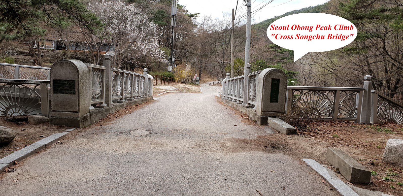
protection Jacket and gloves. I started to move to Obong Park information
Center through right side valley stream for about 10 minutes and reached the
Center and checked hiking course at the guide map and walked on the wide and
easy road for 5 minutes and reached first junction Mark; 1.8km to Yeoseongbong
Peak and 3 km to Obong Peak at Left and Eco Swamp Experience at straight. I
just followed easy walking road and passed check- point for auto counting
number of visitors and continuously climbed over hill and stone stair road for
more than half an hour from the previous junction mark and somewhat remotely
saw Yeoseongbong Peak at left. I took a photo and video at proper angle and kept
on walking for about 5 minutes and faced steep rocky and slippery road and
walking under safety steel support. There was nobody climbing up and down which
I met. I was wondering it might be too early to climb on the mountain under cold
weather, - 8 Deg. C. Anyhow I was ascending hike course for about 20 minutes
and met first post point, Yeoseongbong Peak which looks like female symbol
(rock shape) with fur (pine tree on the rock). I took nice shot to the Peak and
walking behind the rock and found very big somewhat flat rock where I was able
remotely to see gorgeous Bukhansan- Triangle Peaks, Baekwundae Summit at right,
Insubong Peak at middle and Mankyungdae Peak at left as see at the photo. It
was not so easy and common to see clear picture of remote Bukhansan Mountain. There
was also Obong Peaks looks near-by which we called from No. 1 Peak at lowest to
No. 5 Peak through No. 2 Peak, No. 3 Peak and No. 4 Peak as see at the photo. I
moved back to Yeoseongbong Peak as soon as I finished nice shots and came
across so obvious Sapaesan Mountain at left which was not able to see such nice
scenery when I climbed over yesterday because it was too close to see clear
picture, standing at the Sapaesan Mountain. I took a nice shot also and now found
few people climbing Yeoseongbong Peak. I backed to Yeoseong Peak and checked
landmark near-by standing at ridge and stating as 1.2km to Obong Peak and 2.9km
to Jawunbong Summit. I was somewhat easily walking on ridge road for half an
hour and reached Observation Point where I could shot close and obvious Obong
Peak and shot the picture. When I walked on harder and steeper road for more
than half an hour after Observation Point, I found Songchu Junction mark
stating as 2.5km to Songchu Valley at left and 1 km to Jawunbong Summit at
right. I afterword soon faced so steeper and harder climbing road in front
which I passed really difficult rocky road climbing over under full support of
safety steel pipe or rope and hardly reached next landmark for about a quarter
minutes effort saying as 700m to Jawunbong Summit at left. I was walking down
at the landmark for some time and climbed on very steeper wooden stairs
junction and almost struggling steeper uphill road and wooden stairs for about
40 minutes and reached gorge between Manjangbong Peak at left and Jawunbong
Shinseondae Summit at right. I was supposed to climb on really and highly
slopped and slippery rocky road under severe windy and eventually touched down
739.5km Shinseondae Summit after about 5 minutes struggling works and took nice
shot around view of the Summit and rushed down since wind was too strong to
stay there on top as well as so many climbers were climbing on top, limited top
area under steel safety fence and probably maximum 10 people at a time. I was
hurry up descending and decided to get back to the Songchu Parking lot 2
through the same ascending road. I came across more close and clear picture of
Obong Peak on the way down form the Summit after about half an hour and took a
nice shot at good angle and back to the Parking Lot 2 after three and half an hour
descending from the Summit.
 |
| Songchu Parking Lot 2 |
 |
| Obong Park Information Office |
 |
| Dobongsan Mountain Guide Map |
 |
| Starting to Ascend the Hike Road |
 |
| First Junction mark; 1.8km to Yeoseong Peak and 3 km to Obong Peak at Left |
 |
| Easy Walking Hike Road at Beginning |
 |
| Round and Squared Stone Stair Road |
 |
| Yeoseongbong Peak on the Way Up at Right |
 |
| Steep and Highly Slopped and Slippery Rocky Road under Safety Steel Pipe Support |
 |
| Yeoseongbong Rock Looks like Female Symbol |
 |
| Triangle Peaks on the Bukhansan Mountain at Yeoseongbong Peak Position |
 |
| Obong Peak at Yeoseongbong View Position from Peak No 1 at lowest to No. 5 at highest. |
 |
| Exceptionally Clear View of Sapaesan Mountain at Yeoseongbong Peak Position |
 |
| Landmark at Yeoseongbong; 1.2km to Obong Peak and 2.9km to Jawunbong Peak |
 |
| Comparably Easy Walking Ridge Road |
 |
| Closer View of Obong Peak at Observation Position |
 |
| Songchu Junction at Obong Ridge; 2.6km to Songchu Valley at Left and 1 km to Jawunbong Peak at Right. |
 |
| Landmark; 700m to Jawunbong Peak. |
 |
| Walking Down for a While through Stairs |
 |
| Gorge between Jawunbong at left and Shinseondae at Right |
 |
| Dobongsan Three Peaks Information at the Gorge |
 |
| Last Pitch Climbing over Heavily Steep and Slippery Rock Road to Shinseondae Summit. |
 |
| Manjanbong Peak at Shinseondae Summit Position |
 |
| Jawunbong Peak at Shinseondae Summit Position |
 |
| Remote Obong Peaks at Shinseondae Summit Position |
 |
| Remote View of Bukhansan Mountain |
 |
| Remote View of Sapaesan Mountain at Proper Observation Position on the Way Down |
 |
| More Clear View of Obong Peaks at Proper Observation Position on the Way Down |