1.
Date and Time : May 20, 2018 09:00~14:30 (6
hours 30 minutes including break one hours).
2.
Location : Uijeongbu City at Gyeonggi
Province in Korea.
3. Distance and Course : About 15.0km.
Course is to start at KNPS Wondobong Information => Deokcheun Spring => Mangwolsa Temple => Podae Ridge =>
Sapaesan Summit (552m Altitude) => KNPS Heoryong Information.
4. Access :
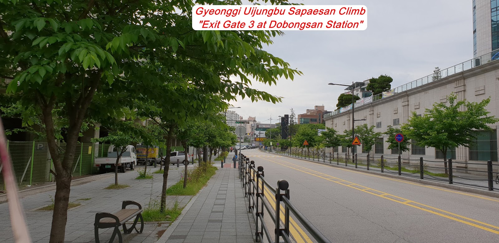
There are various ways connecting or changing to the Subway Line No.1 where you are supposed to get off at Dobongsan Station. As soon as you get off, you should exit through Gate 3 and find the Four Way Junction at the Dobongsan Station where you turn right and keep walking to Dobongsan Mountain direction following the map of “Walking from Dobongsan Station to Wondobong Information”. You could see the Wondobong Information after about 20 minutes walking from the Dobongsan Station. On your way back after touch down Sapaesan Summit, you should walk back to Jawunbong Peak about 1.2km where you should reach the Junction turning left downhill to Hueryong Information 2.5km and keep walking down to Hueryong Subway Station, about 20 minutes referring to the map of “Walking from KNPS Hueryong Information to Hueryong Station” on hilly road.
5.
Overall
Remarks.
Sapaesan Mountain Summit (552m altitude) in Gyeonggi Province is linked with Dobongsan Mountain (740 altitude) in Seoul City which is not so high altitude like Dobongsan. But when you look around mountains around Sapaesan Summit, you should naturally realize that location should be one of the best among several peaks around Dobongsan and Bukhansan. It is not suitable to look the Peaks on top of Dobongsan Mountain and Bukhansan due to too closed to look the overall vast peak. That means distance from the Sapaesan Summit to Dobongsan Peaks and Bukhansan peaks is a good and optimum for looking whole peaks with suitable angle. These are a main reason why people like to climb the Sapaesan Summit extending from Dobongsan Mountain. As explained at the Dobongsan Mountain Climb Course attached herein, I started to climb at Wondobong Information and kept walking up the somewhat steep valley where Mangwolsa Temple, beautiful temple is elegantly situated under beautiful Podae Ridge and reached to the Sapaesan Summit via Podae Ridge which is positioning on top of Podae Ridge around middle of the Sapaesan Course today.
6.
Detailed
Course Information
As
explained at Article 3, I walked to KNPS Wondobong Information after about 20
minutes from the Dobongsan Station and started to move through small and narrow
path at the local village and ticket booth which need no longer for entering
ticket. When I made a hard effort to climb rocky hill and sometimes crossing
the bridge and/or stone stairs for about 40 minutes, I reached junction
landmark saying as 1.1 km to Mangwolsa Temple and Podae ridge 1.6km. I kept continuously uphill through rocky and
steep stone stairs and sometimes road for 10 minutes and found landmark saying
as 800m to Mangwolsa Temple. There is Deokcheun Mineral Water Spring which I
met after 15 minutes climbing from previous landmark. But it was very less
water drop at the square reserves and no need to spend a time for collecting
this mineral water; people were waiting for their turn as a queue. I continued
to climb the valley for about 45 minutes and met the Mangwolsa which was built by
Haecho month for the Shilla Dynasty in AD637, Shilla Dynasty. I saw so nice
scenery of Mangwolsa Yeongsanjeon, one of annex Temple which was elegantly sitting
and going well together with the Podae Ridge. Please see nice picture at the
photo. As I climbed uphill for an half an hour through some steep and road, I
reached three way junction, the one 1.4km to Jawunbong Peak and the other 2.5km
to Sapaesan Summit and turned right at the junction and heading to the
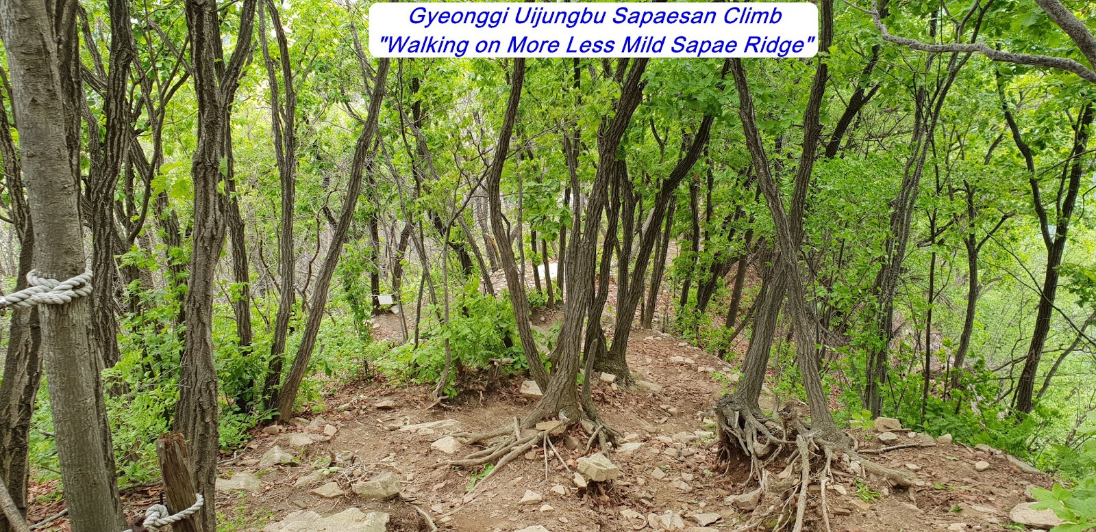
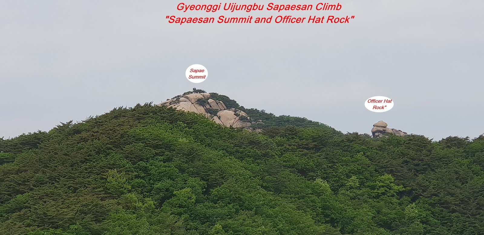
Sapaesan. When I walked on rocky and sometime comparably mild ridge for about
half an hour from the junction, I passed so good and clear view of Sapaesan
Summit and Officer Hat Rock, not far from the summit. Please see at the photo attached.
I made just some more walking for about 5 minutes and reached three way junction
again, the one 1.2km to Sapaesan and the other 2.5km to Hueryong Information and
kept walking the same direction to Sapaesan. But I made clear remind I should
back to this junction again after touch down to Sapaesan Summit on my way back
to home via Hueryong Information and Hueryong Station later. I kept heading to
Sapaesan through comparably mild ridge and last somewhat steep stone stairs for
about 50 minutes from the junction and finally touched down Sapaesan Summit
(552maltitude). There were so clear view of Dobongsan Mountain and Bukhansan Mountain
which was even remotely situated. I took a photo of major peaks at these two
mountains and left clarification which one for Dobongsan and for Bukhansan. Please
see the photo with explanation. I should now go back to the three way junction
where I should turn left for Hueryong Information and Hueryong Station. Please
refer more details to the map of “Walking from Hueryong Information to Hueryong
Station”.


댓글 없음:
댓글 쓰기