1. Preface
Consistent effort how to efficiently and safely forward the cargo between Hangang River and West Sea had been made from the generation to the generation. First trial was made in the King Gojeong in Joseon Dynasty about 800 years ago which they were transporting most nationwide taxed goods from various places to the Gyeongchang Warehouse in Mapo, Seoul via Sondeulmok in Ganghwa Island and Yeomha. But these two areas were always raging tied area and troubled area, the one is hardest sailing route and the other normally too shallow river to sail under normal tied condtions so that only possible to sail the vessel under high tied. The Korea Government decided to directly connect between Wontungui Hyun Village in Incheon City and Gulpocheon Creek in Gimpo City in order to avoid these two troubled areas. But they failed to complete the canal since they could not make a canal at hardest rock area for about 400m. Thereafter they were randomly trying to construct the canal but continuously failed due to insufficient technology or infeasible project or strong resist from the environmental movement group. The Government eventually took a determination to perform this canal project under political nation project which could directly start to move under the Government project in 2009 and complete the project in 2011.
.
2.
The Guide Information for Course 3
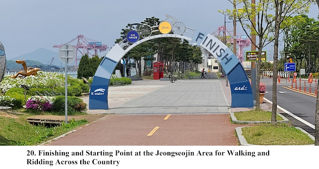
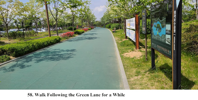
The Gyeongin Ara Waterway Walking Course 3 is starting from the Cheongna Int’l City Station in the Airport Railroad Line and back to the same station via Jeongseojin (The Sign of Stone) and Cheongna Lake Park as about 16 km distance walking for about 4 hours including 1 hour break during the Course. You could start to walk the GAWW Course 3 as soon as walking out the Gate 1 at the Cheongna Int’l City (CIC) Station in the Airport Railroad Line. Please turn right and turn right again and continuously pass under the Station Building Bridge and join the GAWW Course 3 as see at the Photo 01 through 05. Thereafter keep walking following the GAWW Course 3 up to the Jeongseojin (Sign of Stone) via the Jeongseojin Three Way Junction where you should turn right and walk toward the Jeongseojin for 1 Km as see at the Photo 06 through 11, 18 and 25. After you look around the Jeongseojin area well, you could now move toward the Cheongna Lake Park for 5.4 Km via the Jeongseojin Three Way Junction, the Three Way Junction at the Incheon Physical Education High School, Traffic Four Way Junction to the Metropolitan 2nd Ring Express Highway and finally the Gukje Bridge as see at the Photo 29 through 47, 51, 54 through 58, 62. As you finish satisfactorily looking around the Cheongna Lake Park, you could now go back to the CIC Station for about 1 hour walking via the Gukje Bridge and two times Traffic Four Way Junction as see at the Photo 62 through 75. You could also refer to the GAWW Course 3 Map attached and linked to https://www.youtube.com/watch?v=GS02njruUCU
3. Historic and Background Information
There
are several places or spot where some cultural and historic background and
which you may feel interest or useful for your better understanding. Please
refer followings to brief explanation.
3-1) Cheongna International City
Cheongna International City has
been at the Cheongna Dong Town and Beobjeong Dong Town in Seogu District in the
Incheon City which is at the 7.27 Km2 out of total 17.77 Km2 (Seogu District
Area) and presently residing about 110,000 people and belong to IFEZ (Incheon
Free Economic Zone) along with neighboring region, Songdo and Youngjongdo.
Please refer more details to https://www.ifez.go.kr/index. This city has been continuously developing as one of core
global business and leisure center where globally connecting with the Incehon
International Airport and nationwide connection with the Airport Railroad, the
Incheon International Airport Highway, Gyeongin Expressway in South to North connection
and Metropolitan 2nd Ring Expressway in West to East connection.
They could connect West Business Core in Seoul like Yeouido and Mapo area
within half an hour transportation time.
3-2) Jeongseojin (The Sign of
Stone)
Jeongseojin is the Sign of Stone
locating at the Seogu District in Incehon City which indicate correct West point from the Center
of Seoul (Gwanghwamun area) where Kyeongbokgung Palace is. There is another
Jeongdongjin which is completely opposite indication and correct East point
from the Center of Seoul. The Jeongdongjin means the Sunrise with New Hope
while Jeongseojin the Sunset with Romance, Regret and Reminisce. The ceremony
for the Year End and New Year has been held at this location at end of December
every year. There is some additional sculpture and monuments around the
Jeongseojin area as follow.
l Noeuljong (Sunset Bell)
Gorgeous sunset scenery at the
Jeongseojin had been well-known to everybody from long time ago which show fantastic
sunset emitting through and between small islands around. In order to keep this
scenery to the people for long time, The Noeuljong, 21.1 m wide and 13.5 m high
was installed at this location which inspires pebbles at the West Sea and
Restart for Future where you could appreciate this fantastic scenery.
l Bada Piano (Sea Piano)
Bada Piano is near to the Noeuljong
which give you tow sounds, the one is the sound of sea and the other the sound
of piano scale.
l Wish Wall
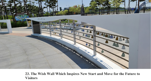
This Wall is for encouraging all visitors with brave and hope in their hard life. There are five symbolic bells at the Wall which means love, wish, friendship, romance and regret which are linked and communicated again with missing people like lovers, friends, families and neighbors.
l Worldwide Sunset Scenes.
l Sunset Observation Point
This point is at the middle of the Worldwide Sunset
Scenes.


댓글 없음:
댓글 쓰기