2018년 9월 15일 토요일

Gangwha Goryeosan Mountain at Incheon City in Korea- Hike


1. 1. Date and Time : Sept 14, 2018.  10:30~13:00 (2 hours and 30 minutes including half an hour break).
2.  2. Location : Gangwha District at Incheon City in Korea.
3. 3. Distance and Course :
About 5.74 km. Course is to start Baekryeonsa Temple Parking Lot  => Baekryeonsa Temple => Junction to Paved Road => Oryeongi Pond => Summit and Observation Point (436m Altitude) => Azalea Observation Point => => Back to Baekryeonsa Temple Parking Lot. Please see attached “Gangwha Goryeosan Hiking Course”.


4. 4. Particular and Summary :
Goryeosan (436m Altitude) is 4th highest mountain out of 6 high mountains in Gangwha district which comes after first one Manisan (472.1m), second one Heolgusan (466m) and third one Jingangsan (443)m. There are three well known temples at the mountain, Baeryeonsa tempole, Cheongryeonsa Temple and Jeoksoksa temple. This mountain is contained and originated with spiritual energy at Goryeo Dynasty which is inclusive of holly pond at top. It is legend story fishes living at the pond was influencing to China sometimes at old days. Five different color lotuses were strangely blossoming at to the Oryeongi pond. Cheochuk Monk picked up these lotuses and threw away at the sky at 4th Year Jangsuwang King in Goguryeo Dynasty and constructed five temples according to lotus dropping location as follow. But there are only three temples at present as stated above.
l  White Lotus : Baeryeonsa Temple
l  Blue Lotus : Cheongryeonsa Temple
l  Red Lotus : Jokseoksa Temple
l  Yellow Lotus : Hwangryeonsa Temple (Disappeared and no records)
l  Dark Lotus : Heukryeonsa Temple (Disappeared and no records)
There is one more legend as Yeongaesomum, Daemakrigi (chief and top official) was borne somewhere Goryeosan area and trained their army at the mountain and used to come to Oryeongi pond for feeding water to his horse.
You could meet the Nakjodae (Observation for Sunset) situating at west which you could meet while you are heading to Jokseoksa Temple through beautiful pine tree forest and reed bushes. Please note brown orange color sunset picture is one of eight sceneries at Gangwha District. There are pink color azalea blossoming in April every year at the mountain which looks like burning with pink color at the mountain. Azalea Festival is holding every year in April by Gangwha District.
You could read more details at https://www.youtube.com/watch?v=AaTFE0cEeTs&t=2s
5.  5. Access :
There is various ways to connect Subway Line connecting to Seoul Subway Station which you could reach from everywhere. Please change to Arex (Airport Express) line and move to Geomam Station taking 37 minutes at 6th stop. You could refer to map of “Transportation from Seoul Subway Station to Gangwha Bus Terminal”. There is no public transportation from Gangwha Bus Terminal to Baekryeonsa Temple. Therefore you should take taxi at the terminal taking 15 to 20 minutes which you would better book the taxi for your return since no taxi available at the Baekryeonsa temple area.
But you would reduce this transportation time to 5 hours for round trip in case you use private car or rent car which you could save one hour for the transportation. 
6.  6. Overall Remarks.
      It was very fine and good day for hiking, sky high and clean air with beautiful cloud. I was first of all looking around Baekryeonsa temple situating foot of Goryeosan Mountain looks so nice and wonderful. I kept so beautiful temple scenery at the photo as well as at the video linked above. I came out from the temple and turned right to hiking start point at the wooden stairs and found a bit high sloped uphill. I walked up the stairs and continuously ascended somewhat heavily inclined uphill road for about 10 minutes from the start and reached 3rd wooden stair road and kept walking over the stairs and found junction connecting to paved road leading to summit and Azalea Observation Point. I turned left at the junction and walked on a bit easy walking paved road for few minutes and found Oryeongi Pond which is explained detailed story at above article 4 “Particular and summary”. As I walked up a little more after Oryeongi Pond, I met Observation point where I could see Azalea observation Point which is crossing over front valley. I saw so beautiful nature view at the Observation and took several photo and videos. I crossed over the valley through wooden deck road and reached Azalea Observation point and continued to walk for half an hour and found the  Gocheonri Dolmen Site. They said “Dolmen is tomb for chief lead at old days, maybe bronze age. Principal structure is two big supporting stone wall and covered with big flat stone”. Please see at the Photo attached. I walked back through ascending road as soon as I looked around the dolmen and took a photo.


2018년 9월 12일 수요일

2018-09-10 Updating with Photos - Gyeonggi Paju Bihaksan Climb in Korea- Bihaksan and Janggunbong Course


Gyeonggi Paju Bihaksan Climb in Korea- Bihaksan and Janggunbong Course
I already hiked Bihaksan Mountain on June 4, 2018 and still remember there was smoke in the air which I could not took a clean and nice photo at that time. I made hike again for such nice picture. I ascended through the same course which I took last time and descending through ascending course different from last time. Please link related video for overall summary https://www.youtube.com/watch?v=nYTk-wc3iH0


2018년 9월 10일 월요일

Seosan Deoksungsan Mountain at Choongnam Province in Korea- Hike


1. Date and Time : Sept 5, 2018.  9:00~12:30 (Three and half an hour including one hour break).
2.  Location : Seosan City in Choongnam Province in Korea.
3. Distance and Course : About 8.21 km. Course is to start Sudeoksa Parking Lot => Sudeoksa Temple => Hyangungak Hermitage => Mangongtap Pagoda => Jeoghaesa Temple => Deoksungsan (495m Altitude) => Back to Sudeoksa Parking Lot through Ascending Course. If you like to overlook on video, please link to https://www.youtube.com/watch?v=a5OC7slfXsM&t=431s. 


4. Particular and Summary :
Deoksungsan Mountain is situated at Yesan District in Choongcheong Province which is inclusive of many extremely strange rocks and very curious landscapes and nominating as Provincial Parkat March 6, 1073. Natural scenery is so beautiful and sometime calling as Hoseo Keumgansan (South West Golden Mountain). There are many reputed hermitages here and there on the mountain which many visitors come and see.
Sudeoksa Temple is first built by Seungje, Buddhist Monk in Baeje Dynasty on the Deoksungsan Mountain which was renovated by Naong Monk in Goryeo Dynasty. There was another records this temple was built by Jimyeong Buddhist Monk at the 1st Year of King Beopwang in Baeje Dynasty which was renovated by Wonhyeo Daesa (Great Monk). But present Daeungjeo (main temple) was built at the Year 34 in King Choongryeol in Goryeo Dynasty which was positioned with Buddha Statue. We could say this temple is the oldest wooden house in Korea based on confirmed records.
5.  Access :
There is several ways to connect “Seoul Express Bus Terminal (”connecting at subway lines No. 3, 7 and 9) where you should get on Express Bus bound for Naepo Shindoshi Express Bus Terminal, non-stop and taking 1 hour and 40 minutes. When you get off at the Naepo Shindoshi Express Bus Terminal, you should walk to Naepo Shindoshi Intercity Bus Terminal taking about 1 minutes for about 45m distance and get on local Bus No 990 there taking 38 minutes for 17 bus stop passing and get off at Sudeoksa Bus Stop and walk to Sudeoksa Temple taking 7 minutes for 441m. Please refer more details to the “Transportation from Seoul Express Bus Terminal to Sudeoksa”. You could simply take reverse course on your way back home. I could estimate total transportation is about 3 hour for one way which comes total 6 hours for round trip. But you would reduce this transportation time to 4 hours for round trip in case you use private car or rent car which you could save two hour for the transportation.
6.  Overall Remarks.
Deoksungsan Mountain has been nominated by KFS (Korea Forest Service) as 100th reputed mountain Korea taking into account following points. There are many strange elegant rocks going well together with beautiful nature scenery and appointed in 1973 as Provincial Park. Sudeoksa temple, widely well known to most people in Korea was situating on the Deoksungsan Mountain and Maaebul (Buddha on Cliff Rock) noticed as national treasure No 355.
6-1) Sudeoksa Temple
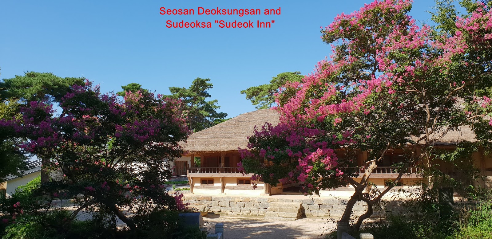
I walked through small village at Deoksan District which is mainly tourist business for major income as soon as I parked the car and reached Sudeoksa External Entrance Gate (First Gate) after about 5 minutes walking from the parking lot. There is ticket booth at the Gate stating as KRW 3,000 for adult, KRW 2,000 for teenager and KRW 1,000 for children. When I passed the ticket booth, I encountered neat and fresh air road connecting to Sudeoksa Temple which is well organizing various lining up on the way at right and left. As I walked this road for about 6 minutes, I reached 2nd temple gate mentioning as Deoksungsan Sudeoksa in Chines. There is traditional Sudeok Inn at left which looks traditional style house at really nature atmosphere as see at the photo and thereafter stone monument of Sudeoksa Temple at left on the way. I passed Sacheonwangmun (Four Heavenly Guardian Gate) after 10 minutes walking from the Sudeoksa Gate (2nd temple). I passed the Sacheonwangmun Gate where four guardians are taking care of four directions at heaven, east, west, south and north. As I walked this gate, I found Commemoration for Sudeoksa Temple Museum and temple layout map which we could see what is where at the temple. As soon as I pass the Temple Information and walked up on stone stairs and saw seven story stone pagoda at left and Sudeoksa Main Entrance Gate in front. I finally reached Sudeoksa Daeungjeon field where I could see all major temple facilities like Daeungjeon (Main Temple House), Beonjonggak (Temple Bell House), Beomgogak (Temple Drum House), Hwaneumjeon (annex temple house), Myeongbujeon (annex temple house) and Samcheungsoktap (three story pagoda). I stood somewhere middle of Daeungjeon temple field and saw so spectacular scenery matching together with elegant surrounding mountains. Please see the photo relating to these facilities. I spent about 10 minutes walking around these facilities and moved to mountain hike course junction.       
6-2) Deoksungsan Mountain Hike
I turned right on the way down from the Daeungjeon temple and headed to Deoksungsan Mountain Hike starting point and found at the corner of the temple landmark stating as 1.89km to the Deoksungsan Summit and 0.96km to Jeonghaesa Temple subsidiary to Sudeoksa Temple. They mentioned there are 1,068 stone stairs from this point to Jeonghaesa Temple which should be sick of continuous almost countless stone stairs at very sharp incline, sometime almost vertical. When I walked up these stairs and following valley stream and hearing nature sound like stream, wind and bird for about 20 minutes, I met landmark saying as 1.36km to the summit. I kept on walking up these stairs for 10 minutes and found Maaebulsang (Buddha on Rock Cliff) where I quickly looked around. I just walked up on the stairs about a minute or two and reached Mangongtap Pagoda made with Mangong Monk. I shortly took a break and contineo9usely moved up and found landmark saying as 1.11km to the summit. As I walked about 3 to 5 minutes, I found Jeonghaesa Temple at left which I could unfortunately not enter the temple due to monk’s asceticism. I continuously walked the hike road for about 10 minutes and found junction landmark stating as either taking left course going to the summit for 500m or taking right course going to the summit for 750m. I choose left course, shorter distance and carried on walking through stone stair road and ordinary mountain narrow road for about 20 minutes and reached next junction stating as 740m to the summit. As I turned left at the junction, I kept walking up through stone stair road and struggled against inclined granite big rock for about 15 minutes and reached next landmark stating as 160m to the summit. I continuously walked on small and narrow bush path for about 15 minutes more and eventually touched down summit saying as 495m altitude and looking around the summit. But I could not see surround view because taller tree are fencing around the summit. I took some photo and video and started to descend and walked down for about 5 minutes and found proper open landscape where I could look down some surround view and took a photo and video. When I descend the mountain for about 1 hour and returned Sudeoksa Temple again and took so nice temple picture again and finally back to Parking Lot after 15 minutes walking down from the temple.